Perlumbaan Kini Adalah Di Antara Misi Pandemik Dan Sasaran Imuniti Kelompok
Oleh Infomedikini
Pada 13 Mei 2021
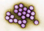
Pandemik 2019 masih menular apabila virus SARS-CoV-2 berjaya mengekalkan kelicikannya.
Setakat ini COVID-19 telah berjaya menjejakkan kaki di lebih 90% wilayah dan kawasan yang mempunyai sempadan antarabangsa.
Varian, penularan dan gelombang
Kemunculan 3 varian iaitu B117, B1351, dan P1 adalah kekuatan yang diperlukan oleh pandemik untuk meneruskan momentum dalam gelombang ke-3.
Selain kepatuhan kepada SOP, vaksin adalah perisai yang disasarkan mampu mengekang gelombang yang tersedia ada.
Tatkala vaksin nampak mampu melandaikan lengkung pandemik di beberapa penjuru bumi, muncul pula varian lebih licik iaitu B1617.
Menurut Maria Van Kerkhove, Pengarah Teknikal WHO varian ini perlu diberi perhatian dan kebimbangan kerana amat mudah menular.
Justeru apakah kebimbangan yang dizahirkan oleh wakil WHO itu bermakna pandemik global ini bakal memasuki gelombang seterusnya (gelombang ke-4)?
Bebas pandemik
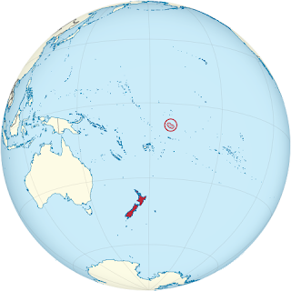
Meskipun penularan pandemik ini tidak mampu disekat oleh sempadan antarabangsa namun setakat ini masih ada beberapa wilayah yang tidak dapat ditembusi oleh pandemik 2019.


laut yang ada


Kiribati

Officially the Republic of Kiribati is an independent island nation in the central Pacific Ocean. The permanent population is over 119,000 (2020), more than half of whom live on Tarawa atoll. The state comprises 32 atolls and one raised coral island, Banaba. They have a total land area of 811 square kilometres (313 square miles) and are dispersed over 3.5 million km2 (1.4 million sq mi).
Tonga
 Officially named the Kingdom of Tonga is a Polynesian country, and also an archipelago comprising 169 islands, of which 36 are inhabited. The archipelago's total surface area is about 750 square kilometres (290 sq mi) scattered over 700,000 square kilometres (270,000 sq mi) of the southern Pacific Ocean. As of 2016, Tonga had a population of 100,651, 70% of whom resided on the main island, Tongatapu.
Palau
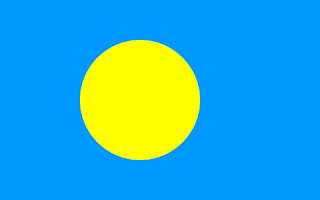 Officially the Republic of Palau and historically Belau, Palaos or Pelew, is an island country in the western Pacific. The nation has approximately 340 islands and connects the western chain of the Caroline Islands with parts of the Federated States of Micronesia. It has a total area of 466 square kilometers (180 square miles). The most populous island is Koror. The capital Ngerulmud is located on the nearby island of Babeldaob, in Melekeok State. Palau shares maritime boundaries with international waters to the north, Micronesia to the east, Indonesia to the south, and the Philippines to the west.
Nauru
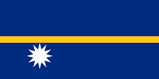 Officially the Republic of Nauru and formerly known as Pleasant Island, is an island country and microstate in Oceania, in the Central Pacific. Its nearest neighbour is Banaba Island in Kiribati, 300 km (190 mi) to the east. It further lies northwest of Tuvalu, 1,300 km (810 mi) northeast of the Solomon Islands, east-northeast of Papua New Guinea, southeast of the Federated States of Micronesia and south of the Marshall Islands. With only a 21 km2 (8.1 sq mi) area, Nauru is the third-smallest country in the world behind Vatican City and Monaco, making it the smallest republic. Additionally, its population of 10,670 is the world's second smallest, after Vatican City.
Tuvalu
 Formerly known as the Ellice Islands) is an island country in the Polynesian subregion of Oceania in the Pacific Ocean. Its islands are situated about midway between Hawaii and Australia. They lie east-northeast of the Santa Cruz Islands (which belong to the Solomon Islands), northeast of Vanuatu, southeast of Nauru, south of Kiribati, west of Tokelau, northwest of Samoa and Wallis and Futuna, and north of Fiji. Tuvalu is composed of three reef islands and six atolls. They are spread out between the latitude of 5° and 10° south, and between the longitude of 176° and 180°. They lie west of the International Date Line.[4] Tuvalu has a population of 10,507 (2017 census).The total land area of the islands of Tuvalu is 26 square kilometres (10 sq mi).
Cook Islands
 The Cook Islands are a self-governing island country in the South Pacific Ocean in free association with New Zealand. It comprises 15 islands whose total land area is 240 square kilometres (93 sq mi). The Cook Islands' Exclusive Economic Zone (EEZ) covers 1,960,027 square kilometres (756,771 sq mi) of ocean.
Svalbard and Jan Mayen
 Previously known as Spitsbergen, or Spitzbergen, is a Norwegian archipelago in the Arctic Ocean. Situated north of mainland Europe, it is about midway between the northern coast of Norway and the North Pole. The islands of the group range from 74° to 81° north latitude, and from 10° to 35° east longitude. The largest island is Spitsbergen, followed by Nordaustlandet and Edgeøya, and the largest settlement is Longyearbyen.
Christmas Island
 The Territory of Christmas Island is an Australian external territory comprising the island of the same name. It is located in the Indian Ocean, around 350 kilometres (220 mi) south of Java and Sumatra and around 1,550 km (960 mi) north-west of the closest point on the Australian mainland. It has an area of 135 square kilometres (52 sq mi).
Norfolk Island
 Norfolk Island is an external territory of Australia located in the Pacific Ocean between New Zealand and New Caledonia, 1,412 kilometres (877 mi) directly east of Australia's Evans Head and about 900 kilometres (560 mi) from Lord Howe Island. Together with the neighbouring Phillip Island and Nepean Island, the three islands collectively form the Territory of Norfolk Island. At the 2016 census, it had 1748 inhabitants living on a total area of about 35 km2 (14 sq mi). Its capital is Kingston.
Niue
 Niue is an island country in the South Pacific Ocean, 2,400 kilometres (1,500 mi) northeast of New Zealand. Niue's land area is about 261 square kilometres (101 sq mi) and its population, predominantly Polynesian, was about 1,600 in 2016. Niue is located in a triangle between Tonga, Samoa, and the Cook Islands. It is 604 kilometers northeast of Tonga. The island is commonly referred to as "The Rock", which comes from the traditional name "Rock of Polynesia". Niue is one of the world's largest coral islands.
Tokelau
 Tokelau is known previously as the Union Islands, and, until 1976, known officially as the Tokelau Islands, lit. "north-northeast" is a dependent territory of New Zealand in the southern Pacific Ocean. It consists of three tropical coral atolls: Atafu, Nukunonu, and Fakaofo. They have a combined land area of 10 km2 (4 sq mi).
Cocos Islands
 The Territory of Cocos (Keeling) Islands (Cocos Islands Malay: Pulu Kokos (Keeling)) is an Australian external territory in the Indian Ocean, comprising a small archipelago approximately midway between Australia and Sri Lanka and relatively close to the Indonesian island of Sumatra. The territory's dual name (official since the islands' incorporation into Australia in 1955) reflects that the islands have historically been known as either the Cocos Islands or the Keeling Islands.
Pitcairn Islands
 Officially the Pitcairn, Henderson, Ducie and Oeno Islands, is a group of four volcanic islands in the southern Pacific Ocean that form the sole British Overseas Territory in the Pacific Ocean. The four islands — Pitcairn proper, Henderson, Ducie, and Oeno — are scattered across several hundred kilometres of ocean and have a combined land area of about 18 square miles (47 km2).
Faktor-faktor yang membolehkan pulau-pulau di lautan Pasifik dan Atlantik ini bebas pandemik adalah: kepongan lautan yang luas dan kedudukan yang terpencil dari arus tumpuan dan pergerakan global.
Cumanya apakah status bebas pandemik dapat dikekalkan atau apakah gelombang ke-4 bakal menyempurnakan misi pandemik seterusnya iaitu: "tiada wilayah yang akan terlepas dari jangkauan COVID-19"!?
Last-Modified: Wednesday, 8 December 2021 04:00:00 GMT


Ulasan